adventure2016 / Utah's Mighty 5
December 31, 2016
 At the end of 2016, to cap off what has been a somewhat disappointing year, we decided to take a trip to the national parks of Utah. Due to the holidays, we only had about 5 days to visit, so it was somewhat of a whirlwind tour. We started out the day after Christmas, bright and early. Well, that was the plan anyway. Being paranoid, I checked one last time to make sure our hotel was booked in Flagstaff for the night. It was a good thing I checked, because I accidentally booked it for the following night. We'd have gotten to Flagstaff without a place to stay. I called to try and change the booking date, but they wanted to more than double the price I originally was going to pay. I chose to cancel that hotel reservation while it didn't cost me anything, and make an alternate plan. After looking at Google Maps, I figured out that it was almost exactly the same distance to Kanab, Utah as it was to Flagstaff, Arizona (441/438 miles, respectively). Since I had no real attachment to Flagstaff, other than I thought that was about as far as we'd want to drive in a single day, I rebooked for Kanab for basically the same price we were going to originally pay in Flagstaff. After that, it was time to head out, really!
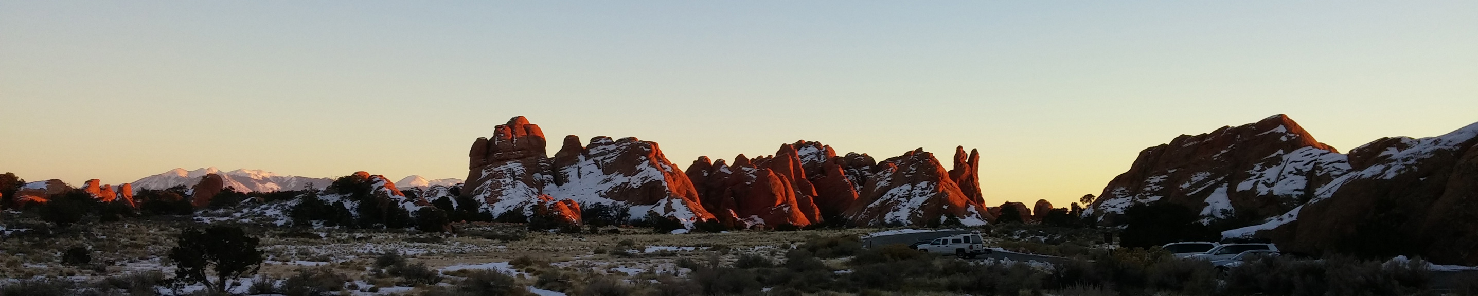
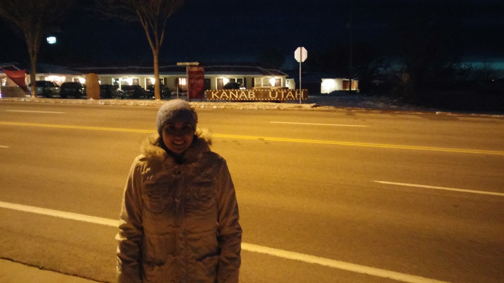
We jumped on the freeway and headed northeast. Traffic was pretty decent considering it was the week between Christmas and New Year's. We drove right on through to Saint George, with only a few bathroom breaks. Our plan was originally to go to Cracker Barrel in Flagstaff for dinner that night, and Alex found that there was one in St. George. Score! We had a nice, late lunch and then got back on the road to Kanab. Finally in Kanab, it was getting dark, but we wanted to go out to walk off some of the huge lunch we ate. We bundled up to brave the 29°F weather outside, and took a walk across Kanab. I forgot to track us on the way out, but it was an out-and-back kind of walk. We saw basically all of Kanab on the walk, but there wasn't much going on, seeing as how it was a holiday and after 5pm. We headed back to the hotel and crashed for the night.
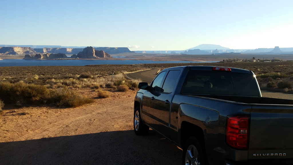
The next morning, we got up before sunrise, had ourselves a free breakfast, and headed east. The plan for the day was to check out Monument Valley and then spend the rest of the day at Natural Bridges National Monument before finishing the route to Moab. Basically traversing the entire width of Arizona/Utah, we stopped in Page to get some gas before entering Indian country. I wasn't sure whether the prices for gas would be insanely expensive or not, and I didn't want to take any chances. My fears were unfounded, as everything within the reservation seemed to be exactly the same as anywhere else in AZ/UT. Along the way, I saw a brown sign mentioning
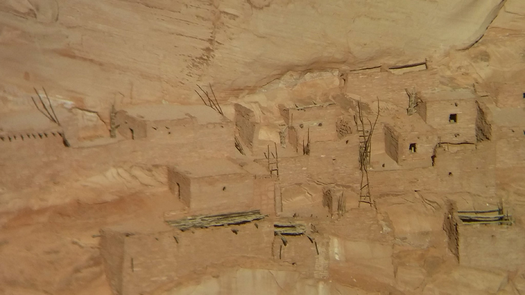
 Navajo National Monument, and we made a spur of the moment decision to visit it. We've had good luck with going to national monuments we see on the side of the road before (Pinnacles). An interesting drive through some pinyon forest brought us to the visitor center. It was a really cool, fee-free park. There are some ancient pueblo buildings to see, and plenty of hiking trails to check them out. Since we were on a schedule, we only did a short walk down to the viewpoint to see the abandoned housing from across the canyon. It was a very pleasant and enjoyable walk, but the viewpoint was a little too far from the pueblo to really experience it. Next time we are in the area, we will definitely do one of the longer, ranger-led hikes to get up close to view the ruins. There was also a lot of neat information about the peoples of the area, past and present, and we even got a cool poster. The time had come, though, to continue on our journey.
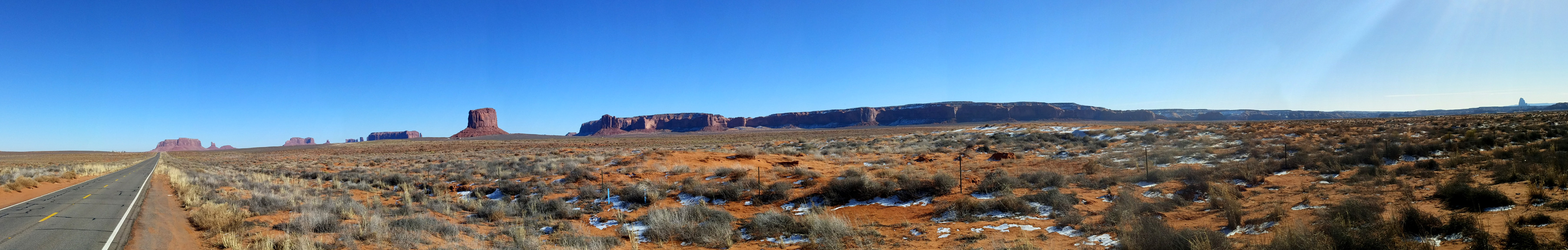
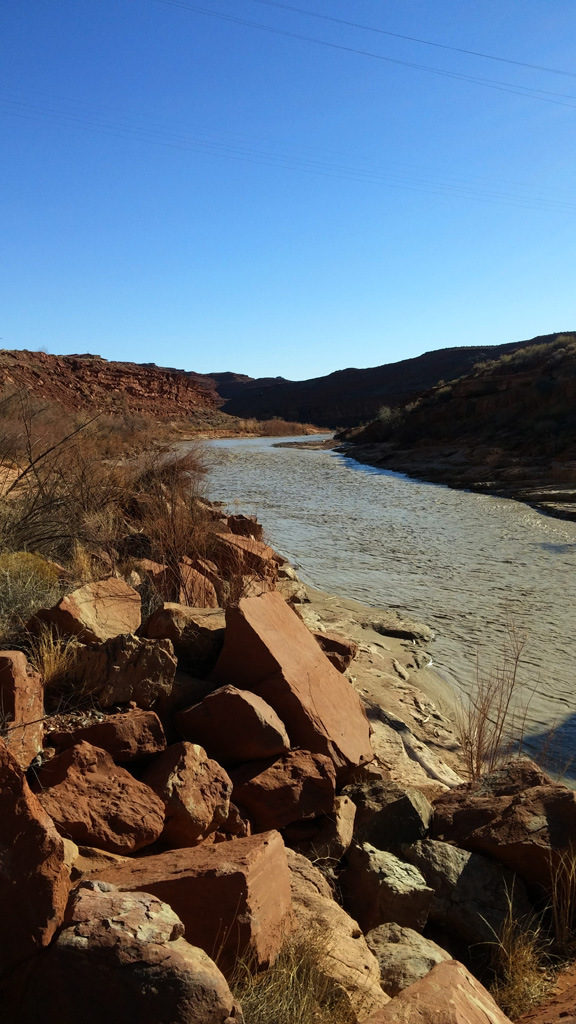
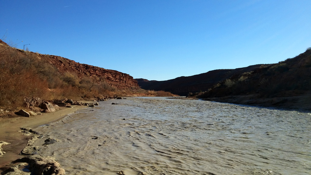
We got to Kayenta, Arizona about lunch time, so we stopped at the Subway in town before heading north. I decided we should skip paying the entrance fee to go into the Monument Valley park and instead just enjoy it from the road, for a few reasons. First of all, we saw basically everything that it is famous for without leaving the highway. Second, we spent more time at the Navajo NM than expected. We stopped a few times to take a few pics along the highway, and eventually made it to Mexican Hat. I wanted to walk down to the San Juan River to get a picture or two and feel the water. The water was very cold and muddy, and I imagined that is what the Colorado River used to look like before we dammed it in multiple places. Eventually, we made our way up the road a bit to
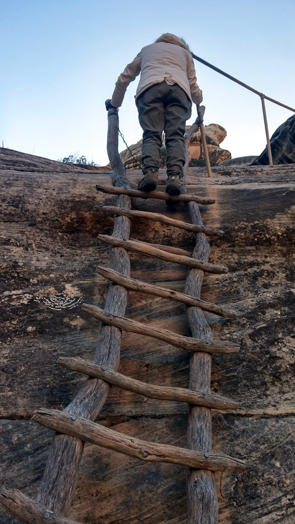
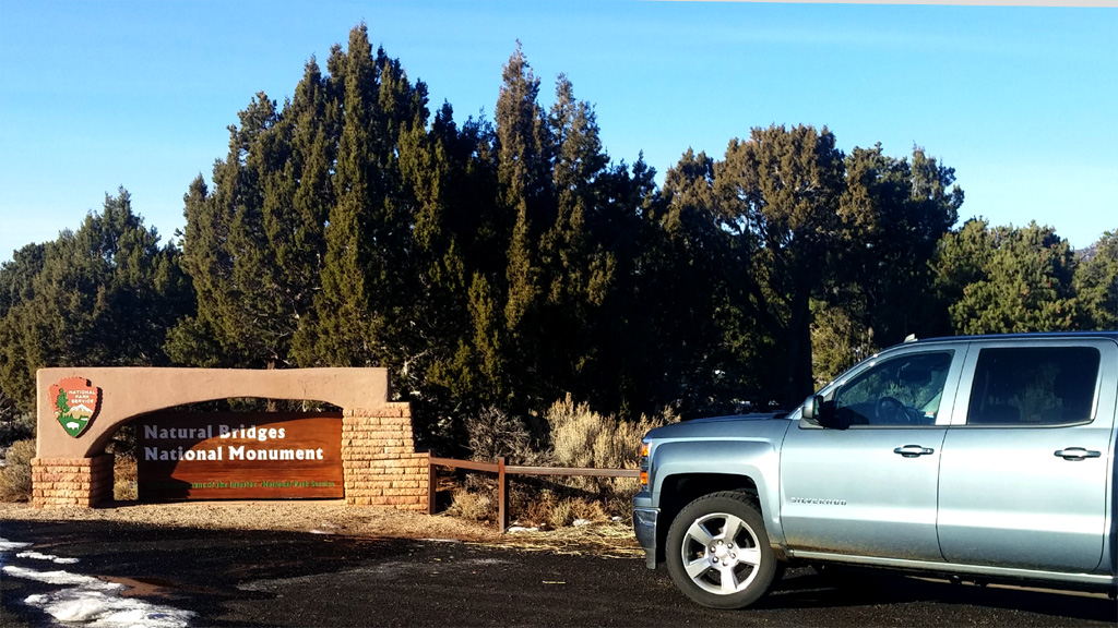
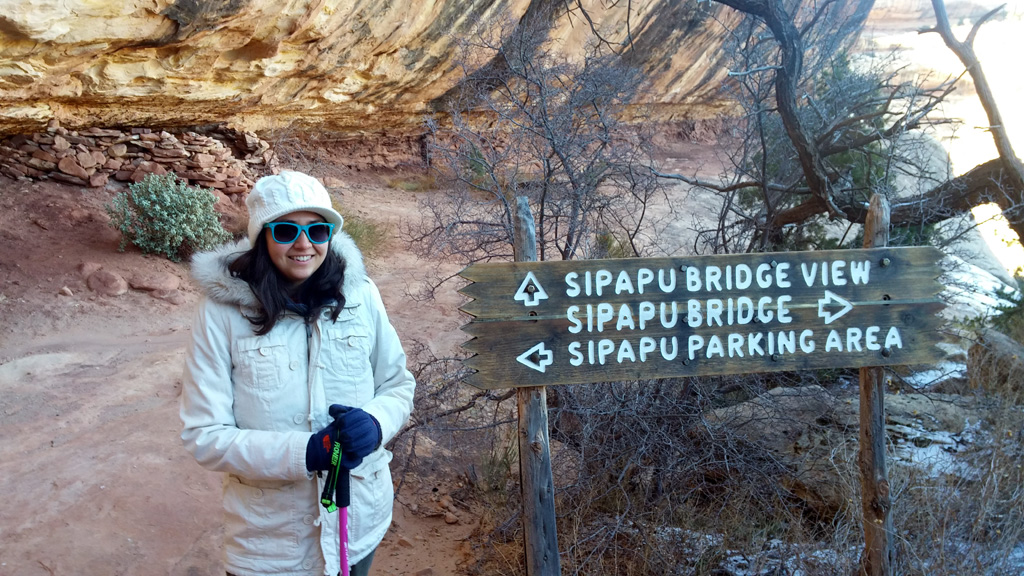
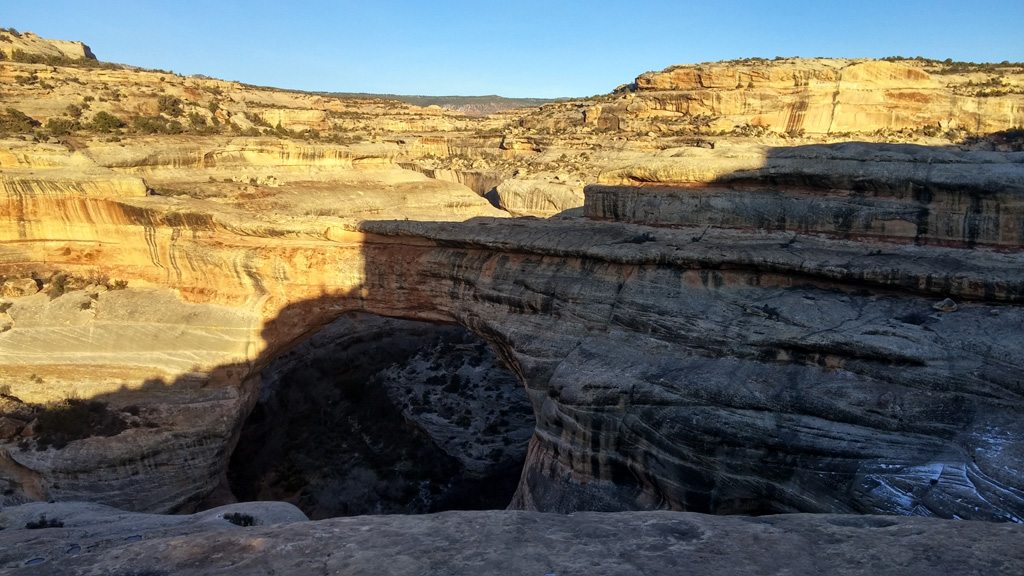
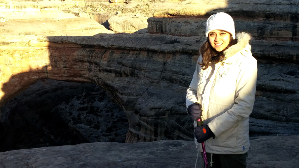
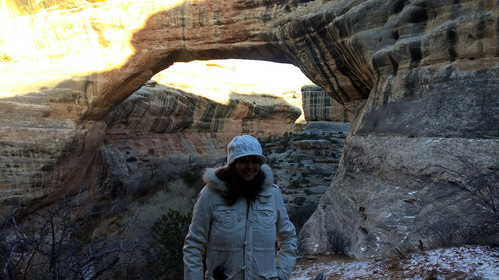
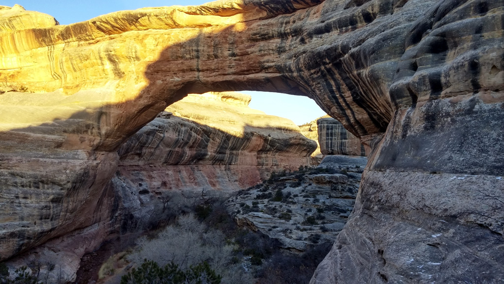
 Goosenecks State Park. There was nobody at the entrance station, and I didn't have small enough bills to pay the $5 entrance fee, so we looked very quickly, determined it is cooler to look at on Google Maps, and kept heading towards our next destination. Along highway 261 in Utah, we came to a point with a bunch of scary road signs near "The Valley of the Gods" warning us about the upcoming road. We had to basically ascend the side of a cliff. It was a little bit scary, mostly because the road wasn't even paved, it was just dirt and gravel, climbing up the side of a mesa. We safely made it to the top, and continued on towards Natural Bridges. Sadly, once we got to the monument, the visitor center was closed for the holidays. It was late in the day, but we had enough time for at least one hike, so we found the parking area for the bridge named Sipapu. It was a really, really fun hike down to the bottom of the canyon, directly under the bridge. [sphere 1412] There were ladders and stairs, and plenty of slick-rock scambling. It was a shame, but by the time we were done with the first hike, the sun had already set, and we were forced to move on. I will definitely be coming back to this park sometime in the future to experience the other two bridges, and maybe hike the long trail between them all.
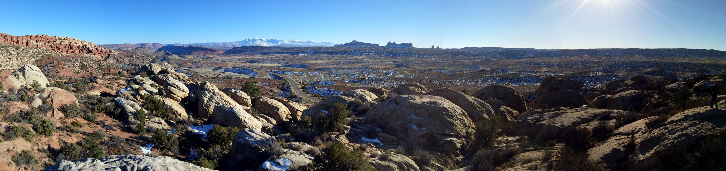
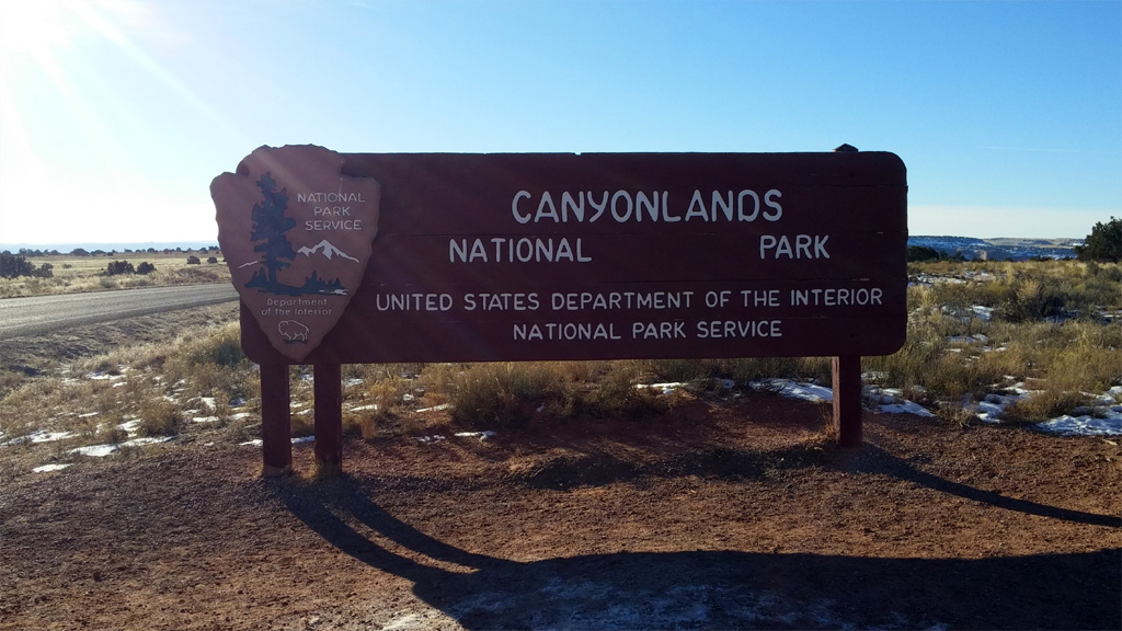
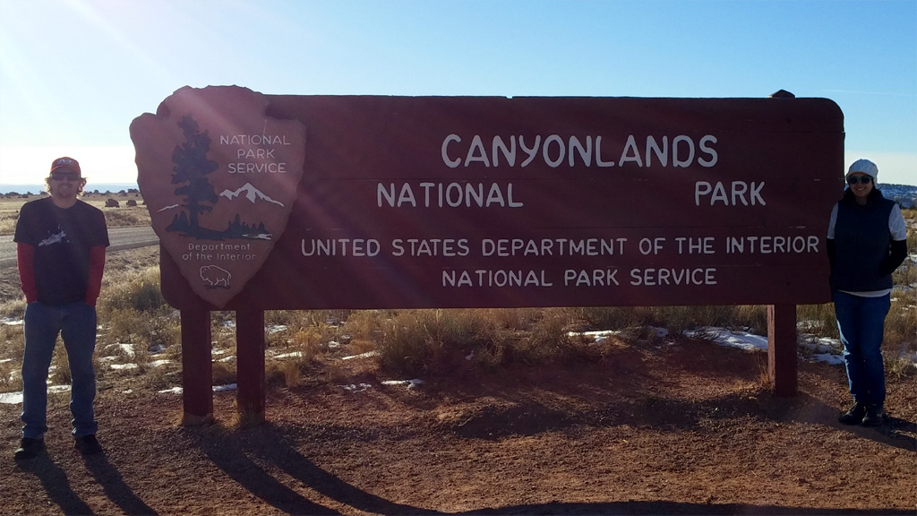
Moab was actually a lot further than expected from Natural Bridges. We drove through Blanding without finding anything good to eat, and then Monticello, where we found Wagon Wheel Pizza. It was pretty good pizza, especially after a long day of driving/hiking. I ate way more pizza than my diet allows, and was content the rest of the drive. We pulled into Moab about 8pm and checked into our hotel. It was pretty cold in Moab, but not terrible. Since it was night time, it didn't seem very interesting, and so we just hit the hay, planning for an early rise in the morning to get to Canyonlands.
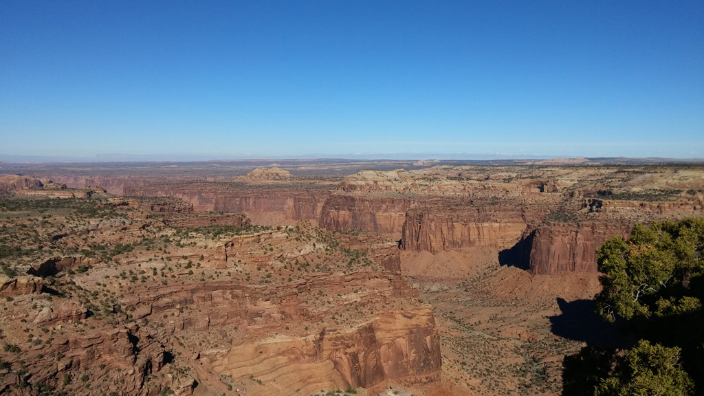
The next morning we woke before the sunrise and had some breakfast. By the time we got all bundled up and ready to go, the sun had risen low over the horizon, and it was amazing. The way the red rocks were just absorbing the light coming over the canyon edge was gorgeous. It was easily one of the most beautiful places I've seen, natural or otherwise. We stopped by the City Market to grab some materials for lunch, and headed to Canyonlands. It was about a 40 minute drive to the park from Moab, and as we were driving towards the entrance, it was easy to see why that district of the park is called Island in the Sky. We were driving on top of a huge mesa and could see for miles in all directions. It was, I daresay, epic. We stopped in the visitor center to learn a bit about the park to find out what we should do. A ranger was very helpful, and she gave us a really useful guide to the park that helped us experience a bunch of things. While we were there, like we do in most national parks we are new to, we watched the video, which was fascinating.
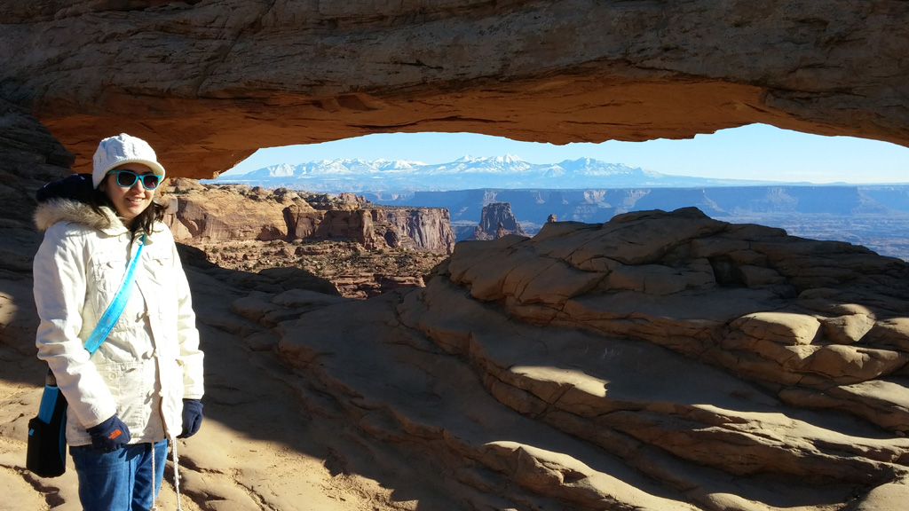
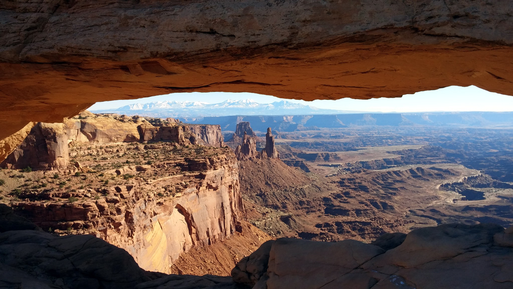
The first stop was the Mesa Arch, just off the main road. It was pretty neat, but nothing compared to arches we'd see tomorrow in Arches. We did the loop trail, which was less than a mile round-trip, got a few pictures, and tried to get away from the crowd. That seems to be the most crowded stop, as it's the first thing after entering the park. We then drove over to the Aztec Butte trailhead and went for a hike to see some old granaries from a long-gone era. It was a very nice hike through some sandy areas and then up some slick-rock to the top of two smaller mesas/buttes. While traversing a slightly precarious portion of the trail near the granaries, I slipped and scared Alex. She thought I was going to fall down the mountain and die. I didn't. After seeing the granaries, we went back down the trail and climbed Aztec Butte to see the ruins at the far end. It was fun following the cairns set up on the rocks and climbing the sandstone to get to the top. The best part of the hike was the actual hike, as the ruins just looked mostly like (and were) piles of rocks.
Another short drive up the road brought us to Upheaval Dome, where we hiked to see the view, yet again. It's a very interesting, yet vexing geological formation. The geologists don't know for sure which of the two leading theories actually caused this massive upheaval. I'm leaning towards the meteorite theory, but they are both fairly sound theories, in my mind. The hike around the dome was pretty cool, and if we had a lot more time to spend, I think I would enjoy the Syncline trail. There were more people along this short trail, a few of which were quite loud, but it was easy enough to get away from them, or let them pass. After the hike, we had lunch consisting of peanut butter and jelly, and some BBQ chips. This was a theme for the rest of our trip. Total cost for breakfast and lunch for the three days we spent in the Moab area was only about $12.
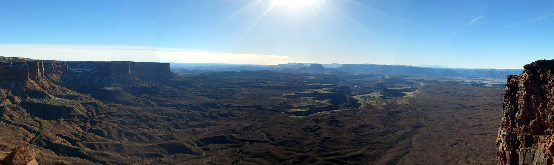
Next up was the Green River overlook. It was an amazing view of the river and the canyon lands below. This is definitely where the park gets its name. It'd have been a perfect place to sit and watch the sunset, but we moved on towards the final stop on our visit: Grandview Point. This was, like Mesa Arch, a somewhat crowded place. Even though it was winter time, I think because of the holidays there were a lot more people than normally would show up in the low temperatures. We found a parking spot, and after checking the view from the paved point, we headed down the trail to see what it was like. It was a mostly flat trail, naturally paved with sandstone slick-rock for most of the way. At the end the view was spectacular.
 I climbed up on some rocks, putting me extremely high above the valley. For a minute it seemed like a good idea, and then I was terrified. After snapping a few photos, I climbed down to be on slightly solider ground. We considered staying out at the point to watch the sunset, but I decided that I didn't want to do the hike back to the parking lot in the dark, even if there were a lot of other people along the trail. We walked back to the truck and watched the sunset from the nearby Orange Cliffs overlook instead. It was a great sunset. We finished the day by driving back to Moab and having some dinner at the Spoke on Center. We both had the "2 Pigs & a Cow" burger, which had a beef patty with bacon and pulled pork on top, along with a couple of onion rings. Dinner was a little bit expensive, especially for burgers, but they were definitely worth it. I also splurged and had a chocolate milkshake with peanut butter cups in it. Definitely I would have gone over on my calorie count if not for the significant amount of hiking we did.
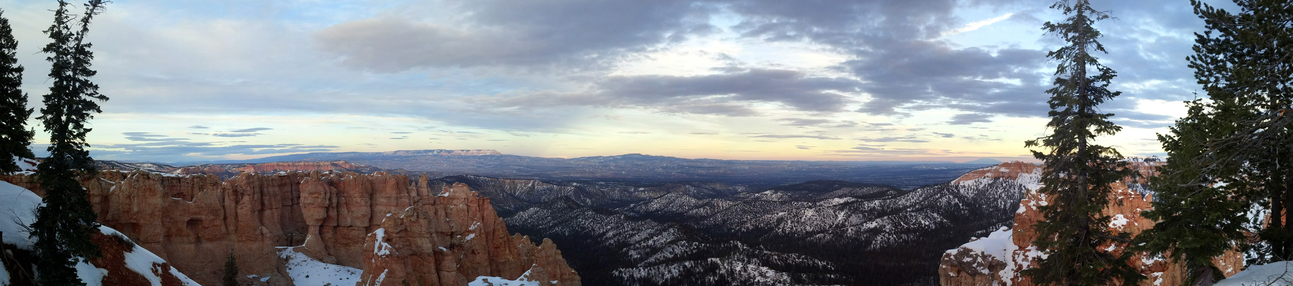
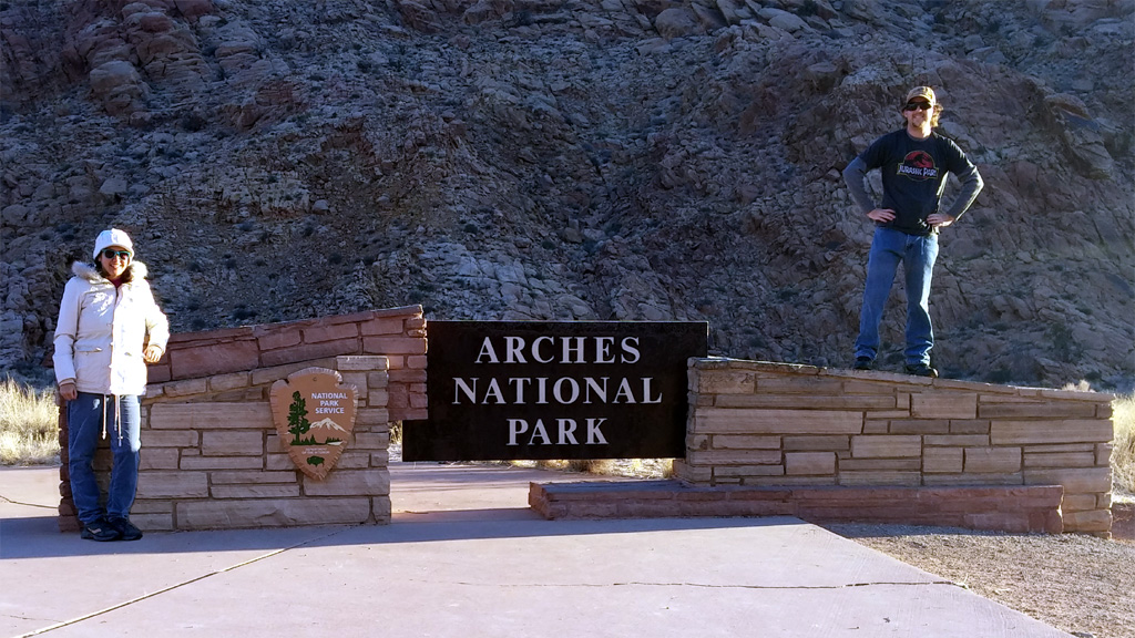
The next morning, we were up again before sunrise, and even had breakfast and got out of the hotel before the sun came up over the rim of the canyon. Today was our day to visit Arches National Park. Arches was much more crowded than Canyonlands was. We got to the visitor center before it opened at 9am, so we just hung around outside, reading through the various information available until they opened the doors. Once we had watched the video and checked out all of the exhibits, we headed into the park. Alex and I were both disappointed, as there was a lot less hiking that we anticipated in Arches.
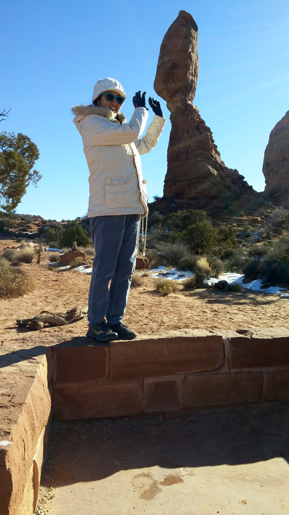
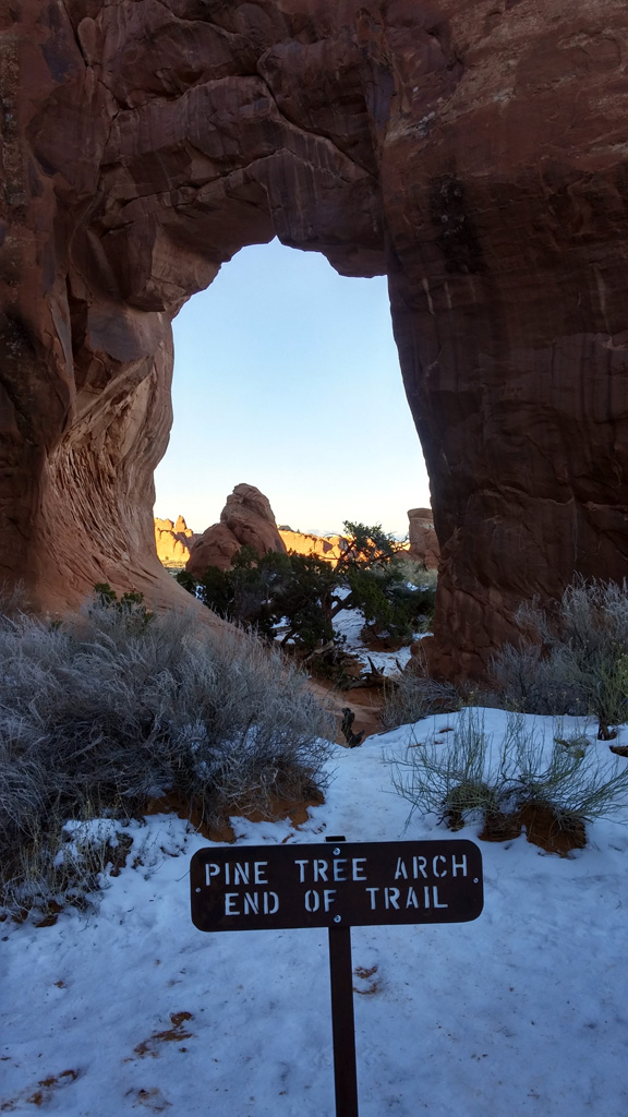
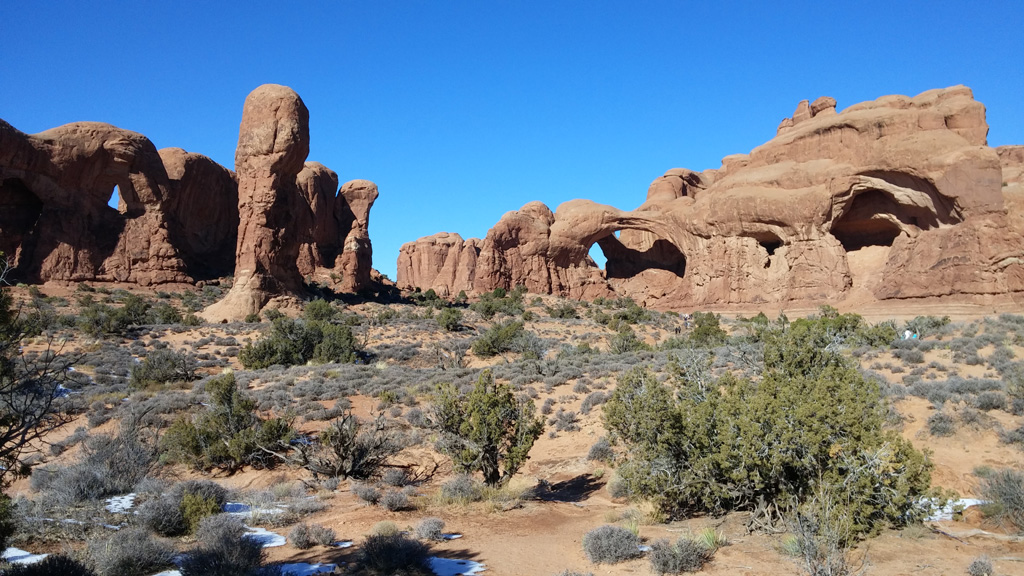
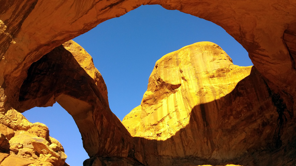
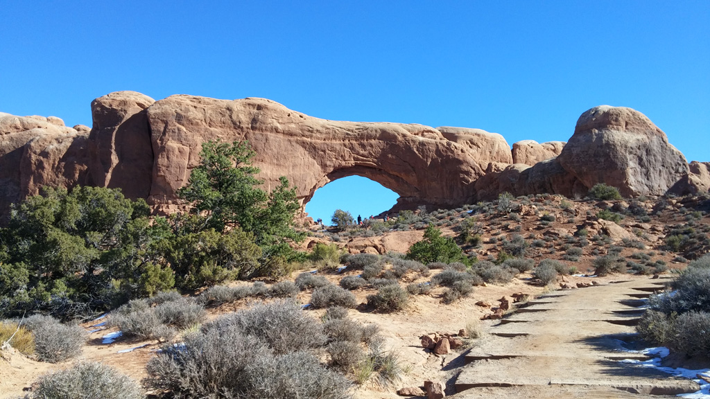
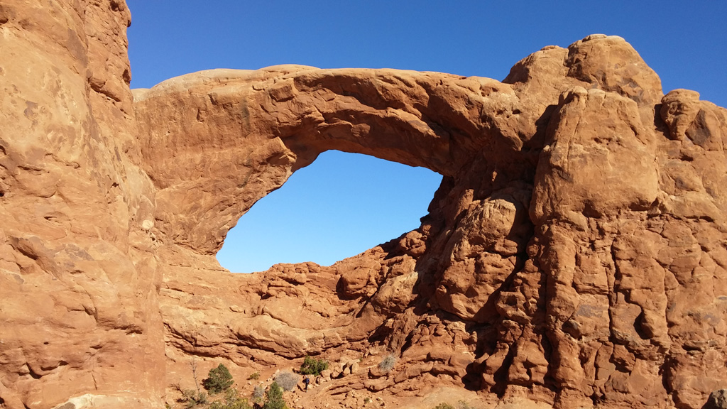
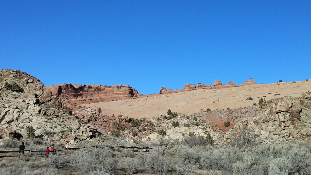
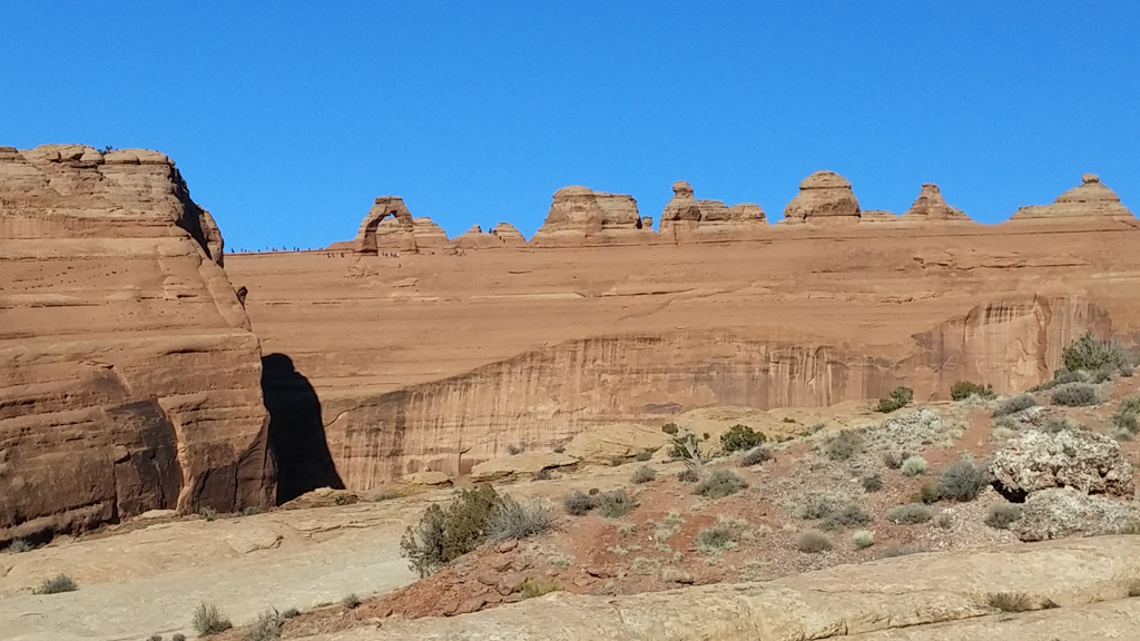
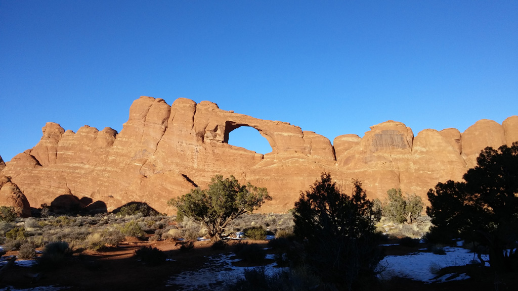
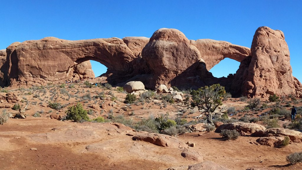
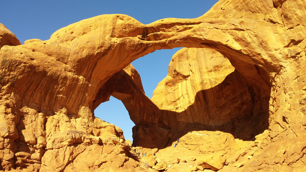 Yes, there were plenty of trails, but they were all either extremely easy and overcrowded, or very strenuous and we didn't have enough time. We saw all the major things in the park that most people want to see when visiting, but it was not my favorite of the parks we visited on this trip. We hiked the "primitive" trail around the backside of the Two Windows, and also hiked around the double arches. We saw Balanced Rock, along with a bajillion other people, and took in some amazing views of the La Sal mountains from Panorama Point. I saw on the map that there were some bathrooms and picnic benches off a short dirt road, so we decided to have lunch there. There wasn't a single person in the area, and it was a nice, quiet lunch. After that, we drove to the Delicate Arch overlook. The parking lot for the hike all the way up to the arch was very crowded, and I didn't feel like doing a strenuous hike with tons of other people. We did hike up to the second viewpoint for delicate arch from across the canyon. It was very scenic, but I am sad that it was so crowded. I wish I would have gone up to the arch to see it up close. After that hike, we drove through the rest of the scenic drive, seeing things like the Fiery Furnace and the Sand Dune arch on our way to the Devil's Garden at the end of the road. We hiked from the far end of the parking lot at Devil's Garden for about 2.5 miles to see Tunnel, Pine Tree, and Landscape arches.
 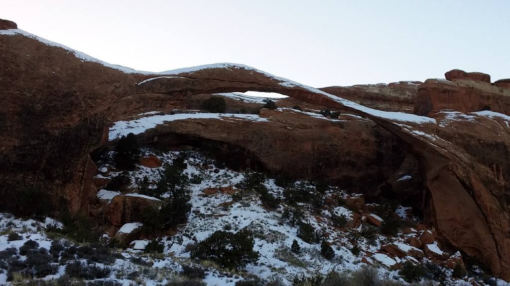 The trail for this area was very, very icy, and people were falling left and right. Alex and I both fell a few times as well. On the way back from Landscape Arch, there was one section that we knew was extremely slippery, since we had to climb up it on the way there. I decided that I didn't want to risk falling down and hurting myself on the hill, so I leaned back, put my arms gently behind me, and slid down the hill on my butt. It was simple and effective, and people cheered for me. After seeing what I did, Alex and a few other people also did the same thing. I was totally a trend setter. About the time we got back to the truck, the sun started to set. As we were driving back down the hill toward the bottom of Salt Valley, it finally did. We did the rest of the drive back to town in the growing darkness. We had dinner at Fiesta Mexicana, and surprisingly, it wasn't terrible Mexican food. Alex and I have had bad luck with getting any kind of good Mexican food outside of California, so we were pleasantly surprised.
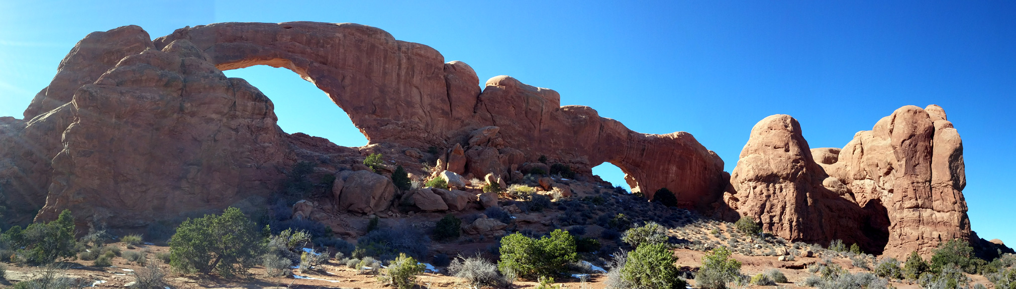
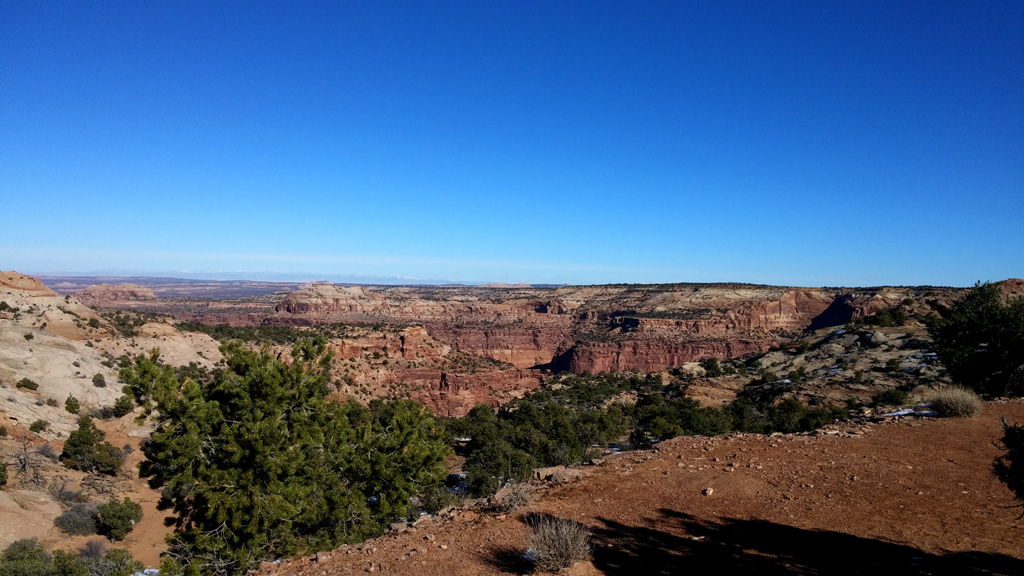
The next day was the first on our journey back home. Instead of trying to cram the whole drive home in one day, we split it up into to. Our stop for the night would be Ruby's Inn at Bryce Canyon, since we love Bryce, and even if we don't get much time, I still love to visit for a little while. Before Bryce, though, we headed to Capitol Reef
 so Alex could buy some more whistle pig bookmarks. She had one from the last time we visited Capitol Reef, but it got destroyed from overuse. This time we bought three, so she has plenty of spares until our next visit. I also picked up a Utah Rocks shirt, since I now felt I could wear it having been to all the parks listed. We did the scenic drive, all the way to the end of the dirt road in Capitol Gorge, and then hiked out to the pioneer register. I missed it on the way out, so we actually walked a little further, almost all the way to the Tanks. We then walked back to the truck and headed for Torrey to get some lunch. Like our last trip, we had to stop at the Red Cliff Restaurant. It was such good food last time, I wanted to go back again. After a nice burger with onion rings, it was a long drive to Bryce. Instead of going up and over the mountains on scenic byway 12, I chose the small highway/road going past Otter Creek. As we drove by the lake, we could see people and tents hovering over the water, so I assume they were ice fishing. After the split between highway 62 and 22, the road got a little smaller, and eventually even the state route disappeared and we were just on a podunk little road called Johns Valley Road. It was windy for some spots, and then straightened out for long stretches, but it seemed to go on forever. Finally we made it to the intersection of the road we were on, SR 12 and SR 63 into Bryce.
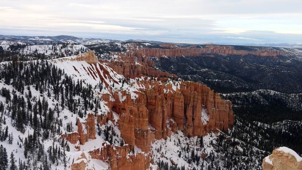
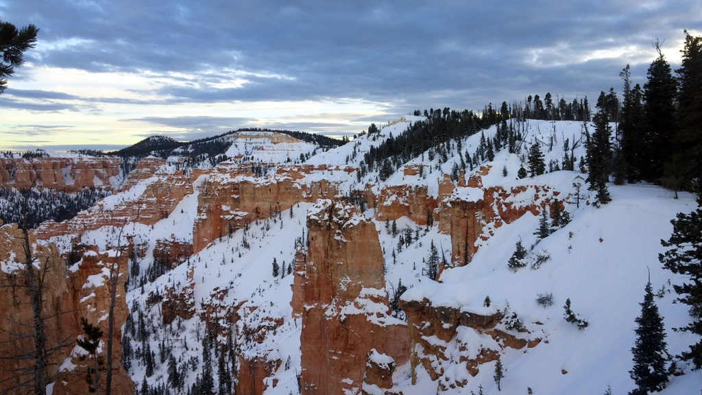
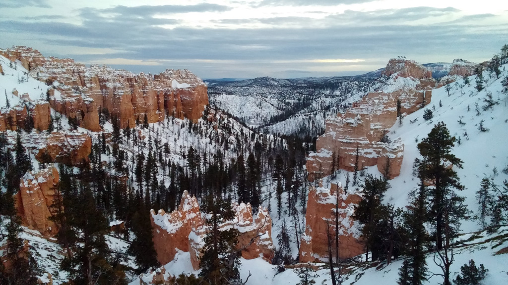 Since it was about an hour before sunset, we headed down to Rainbow Point in the park. Alex wanted to go to the visitor center to check out the new exhibit they were constructing when were here in February, but it was already closed for the day. We did a whirlwind tour of all our favorite spots in Bryce, snapping pictures as we went, and finally the sun went down as we drove out to Bryce Point. There were tons of people there for some reason, and the parking lot was maxed out, so we just headed back to town to check into the hotel. There was a huge line to check in, so we sat down to a buffet dinner first, completely blowing our calorie budget. There was no line after dinner, and it only took a few minutes to check in. We stayed in the Elk Lodge this time, and the room was comfortable, as always.
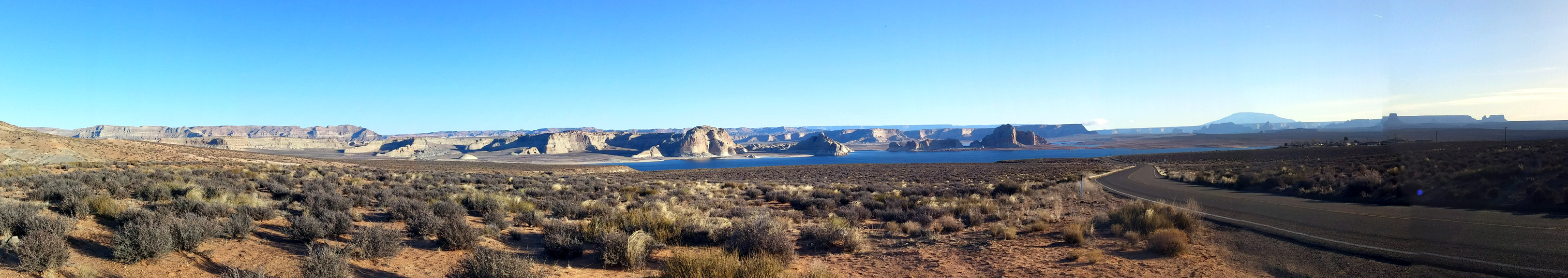
 The next morning the plan was to hit the visitor center at the park before the long, long drive home. We got to the park by 8 and waited for the ranger to open the visitor center up. The new exhibit was very informative, I quite enjoyed learning all the neat things about the various rock layers and such. I feel like maybe I should have been a geology nerd in a different life. We hurried through the exhibit, while still taking it all in, and then it was time to hit the Subway for breakfast. A huge buffet breakfast at Ruby's would have been too much for our long drive home. Sadly, Subway didn't open until 10am, and it wasn't even 9 yet. I made the decision to drive to Mt. Carmel Junction, where I knew there was another Subway to get breakfast. When we got there, it was about 5 minutes to 10, and this one also did not open until 10. That gave us a few minutes to use the restroom in the gas station before ordering our breakfast sandwiches. We also got coffee and hot cocoa before heading down the road to Zion. I didn't want to deal with any kind of traffic shenanigans once we crossed the Nevada/California border, so I wanted to get there as early as possible. That meant we didn't really stop in Zion, just drove from the top to the bottom, skipping the drive up the canyon this time. We'll be back sometime in the near future, so I didn't feel too bad. We did stop briefly to get a picture of Alex wearing her Adventure Begins shirt with the rocks in the background. The rest was just the exciting drive through Virgin Gorge, then the boring drive through 400 miles of desert to our home. Sadly, the only precipitation we saw on our entire trip happened between Barstow and home, so we didn't see any fresh snow being laid down, only rain.
And with that, our trip was complete. We hit Utah's Mighty 5 in a single week! Now we know, for sure, that we want to go back to Natural Bridges and Canyonlands, and it will be one of things to do when we finally move to Utah.